Api Himal
Mountain in Darchula District, Nepal
30.0042°N · 80.9333°E
About
Why visit Api Himal
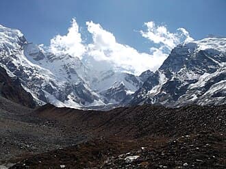
Api, also called Api Himal, is the highest peak in the Yoka Pahar section of the Gurans Himal, a subrange of the western Himalayas, in Darchula District in the far north-west of Nepal, near the international border. At 7,132m it rises dramatically over low surrounding terrain, which makes it look much larger than its height, and it is rarely climbed or visited. Api lies within the Api Nampa Conservation Area, which protects habitat from subtropical river valleys to high alpine zones. Snow leopard, Himalayan tahr and musk deer live at higher elevations. The Mahakali River corridor below Darchula offers a river-canyon landscape that few trekkers see, and villages near the border show a visible Tibetan influence. October to November and March to May are the best seasons. Road access from Dhangadhi is long and landslides can cut it. There is no teahouse circuit, so a guide, camping gear and porters must be arranged in advance, and evacuation is harder than in central Nepal. A conservation-area permit is needed.
Location
Where is it?
Transport
How to get there
All transport options from major cities to Api Himal
Transport information coming soon.
Reviews
What travelers say (0)
No reviews yet. Be the first to share your experience.
⚠ Travel Notes
- ·Api Nampa Conservation Area requires a permit; obtain it through DNPWC in Kathmandu or verify current local arrangements in Darchula, as infrastructure in far western Nepal is inconsistent
- ·Road access to Darchula from Dhangadhi is long and subject to disruption — the Sudurpashchim highway network is still developing and landslides regularly cut routes during and after monsoon
- ·No established teahouse trekking circuit exists here; camping gear, a guide, and porter arrangements must be organized in advance, ideally from Dhangadhi or Kathmandu
- ·Altitude gain is rapid in the upper valleys — acclimatization should not be rushed, and the remoteness means evacuation in a medical emergency is significantly more complex than in central Nepal
- ·Monsoon (June–September) renders most trails toward Api's base extremely difficult due to swollen rivers, leeches, and trail washouts; the Mahakali and tributary crossings become dangerous
- ·Border-zone sensitivity: the area near the Nepal-India-Tibet trijunction may have additional administrative requirements; check current regulations with local authorities before approaching upper elevations
- ·Mobile network coverage is sparse to nonexistent beyond Darchula town; satellite communication devices are advisable for any serious approach into the conservation area
Explore More
Nearby destinations
Where to stay in Api Himal
Compare guesthouses, hotels, and lodges with real-time prices, traveler reviews, and free cancellation on most stays.
More to explore
Other destinations you might like

Khaptad National Park
Alpine meadows and pristine wilderness in Nepal's remote northwest
Kalingchok
Pilgrimage ridge and snow viewpoint at 3,842m

Nagarkot
Himalayan sunrise views and ancient temples above the Kathmandu Valley

Nuptse
Mountain in Nepal